An
exclave is a section of land which is not conterminous with a larger political entity to which it belongs. That is, an exclave is physically separated from the main part of its political unit by one or more other political entities, so that is would be impossible to get by land from the exclave to the main part of the political entity without crossing territory belonging to a foreign entity. An example of such an exclave in the United States is Alaska. (Note that, strictly speaking, an exclave has to be surrounded by alien territory, but in this discussion we will include pene-exclaves, or practical exclaves, such as Alaska, which are partially bordered by their own territorial waters.)
There are quite a number of exclaves in the world, most of them of very local character (for instance as part of a county or city). Over the years, however, there have been some interesting exclaves as part of American states. One of the earliest was what is today the state of Maine, which from the seventeenth century until 1820, when it was admitted as as state, was part of Massachusetts. Another was the Western Reserve, in present-day Ohio, which was an exclave of Connecticut until the year 1800.
Those exclaves were the result of political claims, but there are three interesting U.S. state exclaves which were created becaue of maps, which of course is of particular interest to me. In today’s blog we’ll look at the 17 square miles called the “Kentucky Bend” (also the “New Madrid Bend” or “Bessie Bend”).
In 1663, King Charles II created the Carolina Colony, establishing it to the south of the Virginia Colony with their mutual border being set at 36 degrees, 30 minutes. (This border is one of the most significant borders in the United States, playing a huge role in the history of slavery and the American West, as explained in my blog on
“Shaping the Trans-Mississippi West”). In 1792, Kentucky was created as a state out of the western part of Virginia, retaining the same southern border. Its western border was set as the Mississippi River where 36°30’ intersected it.
Initially, this seemed to be unproblematic, as the 1795 map of Kentucky by Mathew Carey shows. However, surveyors did not actually lay the border on the ground that far west until well into the 19th century (and, indeed, the surveying of the border between Kentucky and Tennessee further east was also problematic, creating anything but a straight line along the 36°30’ border).
As better surveying of the region of western Kentucky, southern Missouri and the Mississippi River around New Madrid was gained, the realization came that the Mississippi River came awfully close to the 36°30’ line in the area, as Anthony Finley shows in his 1824 map.

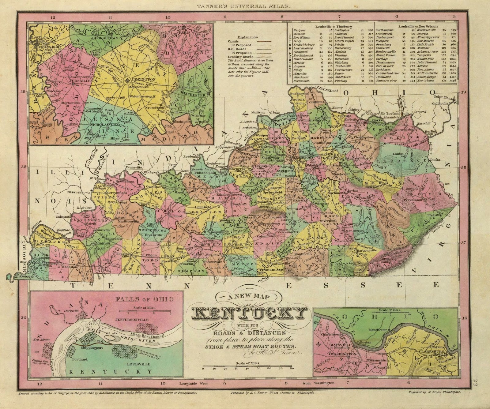
By the beginning of the next decade, it was discovered that the Mississippi River, on one of its meander loops, actually crossed that line of latitude three times, creating a small peninsula which stuck up north of the border line, which made it part of Kentucky, but which was not connected to the main part of the state to the east. This is nicely shown on Henry S. Tanner’s map of 1833. According to Kentucky, that peninsula, though unattached to the rest of the state, belonged to her, as it has been since accepted. Tennessee, however, initially claimed the peninsula as well, only giving up its claim in 1848. The Kentucky Bend is an exclave, as you cannot get from it to the rest of Kentucky without crossing either into Missouri or Tennessee.

Some have claimed that the river originally did not drop south of the 36°30’ line until it flowed past New Madrid, but that its course was changed by the large earthquakes centered on that town in 1811 and 1812. That would have meant that this exclave was originally attached to the rest of the state. However, it does not appear that this shift in the river ever happened (though the Mississippi did, in effect, flow backwards in the region at one time because of those quakes). This unusual exclave, shown on the map above by Jim Efaw, was simply the result of borders being defined on maps before those maps were truly accurate.